Written By
Bianca de Loryn
College/Division
College of Arts, Society and Education
Publish Date
16 June 2022
Related Study Areas
When James Cook sailed to Tahiti in 1768, he met the Polynesians, who had developed a unique way of navigating the seas. In honour of the Day of the Seafarer (June 25), JCU Lecturer Dr Claire Brennan and Associate Professor Cheryl Taylor explain how these traditional navigation techniques are being rediscovered today.
What is Polynesia?
“The Polynesian triangle is that region that lies between Hawai’i, Aotearoa and Rapa Nui – or Hawai’i, New Zealand and Easter Island,” says Claire Brennan, who is originally from New Zealand herself. “Polynesia is huge. It’s a massive portion of the Earth's surface, and the people who became Polynesians originally arrived from Southeast Asia, and kept going.”
These seafaring peoples began settling the Pacific more than three thousand years before James Cook arrived and didn’t stop until they reached Aotearoa, or New Zealand, approximately 1000 years ago.
Measuring the transit of Venus from Tahiti
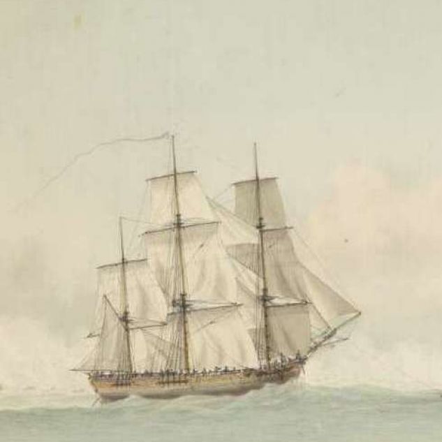
James Cook arrived in the Pacific in 1769, a Lieutenant of the British Royal Navy, who had been commissioned with sailing to Tahiti on his ship, the Endeavour. “Cook was a gifted astronomer, that's one of the reasons he was sent to Tahiti to watch the transit of Venus,” Claire says. Watching the planet Venus cross in front of the Sun was an important mission. It would help scientists calculate the distance between the Earth and the Sun.
While sailors are known to use the sun to calculate latitude, Cook loved astronomy and observed the night sky. “There are places on his voyage that are named for astronomical events. I'm thinking of Mercury Bay in New Zealand, which is named because he observed the transit of Mercury there. So, he observed more than just the position of the sun,” Claire says.
Calculating the Endeavour's position
Cook was looking to the skies every day and every night. “When he's making his calculations of longitude (east and west position), he's doing complex astronomical observations, including of the moons of Jupiter,” Claire says.
One of the tools he used for fixing the position of his ship was a sextant. “With a sextant you can measure any heavenly body. The ‘noon shot’ of the sun is fairly frequently used to get a position at noon,” says Cheryl Taylor, Associate Professor in literature at JCU and a seasoned sailor herself.
Slow sailing around the world
“Because you don't travel very far in 24 hours, you don’t need to do it more frequently. The ships would have gone very slowly, particularly the Endeavour,” Cheryl says.
“Sometimes the Endeavour even went backwards,” Claire Brennan adds. “She was known to be a slow sailor. But she was also affected by the winds and currents, especially when you're sailing in unknown seas and you don't know where favourable currents are.”
The Endeavour didn’t have an engine (ocean-going steam ships were some time off), but they did have determined men and other resources on board. “Cook had a fleet of smaller boats,” Claire says. “He got the boats out when he was in real danger. Then the men were desperately rowing and rowing and trying to drag this ship away from danger.”
Polynesians were skilled navigators
When Cook arrived in Polynesia, Western explorers knew little of the Pacific. The Polynesians on the other hand had found every island between Hawai’i in the north, New Zealand in the southwest and Easter Island to the east. There is evidence that some Polynesians even travelled right across the Pacific to South America.
In Polynesia, Cook saw that Polynesian ships – and especially those in Tonga – were bigger and faster than his own ship. “Polynesian ships tended to be double hulled – a little like modern catamarans – or to have outriggers, which increases their stability,” Claire says. It is thought that they also had sails that were shaped like ‘crab claws’, which is narrower near the foot of the sail and wider at the top.
Exploring the Pacific with Tupaia
After Cook had observed and documented the transit of Venus from Tahiti, he had orders to chart the Pacific and find the great southern continent that the Europeans called Terra Australis. Cook was fortunate to meet a Polynesian priest in Tahiti, Tupaia, who volunteered to show him the islands of the Pacific.
“Tupaia wants to voyage with Cook and he was interested in going as far around the world as he could,” Claire says. “He was of a priestly class and he was an experienced and capable navigator. He was a gifted linguist too, which is part of the reason for the Endeavour's success on its voyage.”
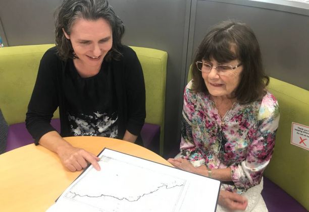
Tupaia also had the knowledge of the Pacific that the Europeans lacked. “Tupaia is a real asset for the crew. He draws a map, and he is able to explain to Cook where various island groups are found. Cook finds these places because Tupaia can direct him to them.”
Navigating the Pacific Polynesian style
With Tupaia’s help, the Europeans learnt some of the ways Polynesians sail the Pacific. Polynesians didn’t have watches or sextants, but they had knowledge that had been collected by previous generations.
“There's patterns of birds, there's a sense of where islands should be and how far off you can see these islands. Reading the winds, reading the currents, understanding flotsam and changes in water colour,” Claire says.
She adds that we don’t know exactly how Polynesians navigated. That was because the Polynesians also learnt how the Europeans sailed. Over time, they forgot their own traditional sailing knowledge as they quickly adopted new technologies.
Rediscovering traditional Polynesian sailing skills
In the 1970s, things started to change, and Indigenous peoples rediscovered their heritage. “So, you get that sense of pride in New Zealand and in the other places within Polynesia which have been settled by Westerners," Claire says. "Polynesians realised that their ancestors navigated the Pacific, and they navigated the Pacific reliably and repeatedly. That is something to take pride in."
Luckily, the tiny islands of Micronesia are among the most remote places in the world. “The old navigational techniques survived there and were still in use,” Claire says.
The transition from sextant to Sat Nav to GPS
However, even in Western countries many sailors still relied on the sun and the stars until well into the 1980s – especially when they were on a tight budget like Cheryl and her husband, Norman Taylor. “Norman had a sextant and a compass. Instead of a Sat Nav [satellite navigation] we had navigation tables, and we would take some shots of the sun, usually at noon,” says Cheryl.
Sat Nav was an early version of GPS that was introduced in the 1980s. It was based on just one satellite. Today, most of us who own a smart phone have a ‘navigator’ in our pockets that knows exactly where we are all the time. Although this technology is helpful, it is of great value that the incredible knowledge of ancient seafarers still lives within the people who know how to look to the stars and sail the Pacific like their ancestors did thousands of years ago.
Learning more about the age of sailing in the Pacific
Claire Brennan is currently working on the “Beyond Cook” project with the JCU Library. "Beyond Cook" is an Open Education Resource, a collection of open access resources available to everyone interested in the history of Pacific exploration. It will be launched in late 2021.
Featured researcher
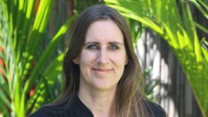
Dr Claire Brennan
Senior Lecturer
Claire Brennan is a senior lecturer in history at JCU. She is an environmental historian and has recently worked on the history of disasters and how people remember (and forget) them. She has published chapters on COVID-19 and the 2019 Townsville flood. Her longer term projects focus on animal history, and she is writing a history of crocodile hunting in northern Australia.
Claire teaches at both undergraduate and postgraduate levels. Since 2021, she has been teaching a subject on Australian and Pacific exploration, as well as a subject on researching history.