Turtles, dugongs in danger from seagrass loss
Large-scale monitoring of seagrass meadows across Hervey Bay and the Great Sandy Strait reveals there’s almost no seagrass remaining across most of previously mapped areas.
The surveys come after two significant flood events in early 2022, and scientists are concerned the seagrass loss could trigger an increase in dugong and green sea turtle strandings.
James Cook University TropWATER Centre is leading the monitoring of 2300km2 of seagrass meadows – one of the largest and most important areas of seagrass in eastern Australia – in partnership with the Department of Environment and Science (DES).
TropWATER Professor Michael Rasheed said there had been drastic reduction of seagrass when compared with previous extensive mapping.
“Our boat surveys show there’s almost no seagrass visible in the 2m to 17m depth range for much of the deeper meadows, and these sites have previously recorded extensive areas of seagrass,” he said.
“There were some areas of sub-tidal seagrass but these were confined to the deepest areas in the northern part of the bay.
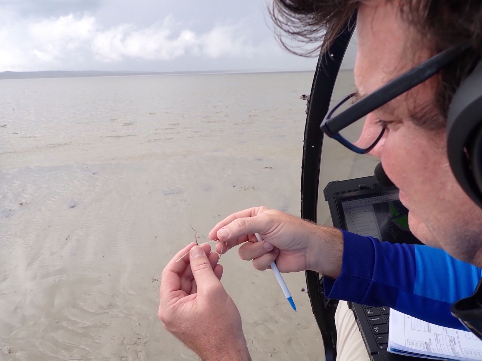
“We also used helicopters to assess more than 1300 intertidal sites throughout the Great Sandy Straits and while some sites had seagrass the cover was typically less than one percent of the seafloor offering scant resources for dugong and turtle.”
Prof Rasheed said the last comprehensive mapping of the entire area was more than 20 years ago, and surveys now were critical to help understand what seagrass resource remains to support dugong and turtle feeding as well as assess the potential for recovery over the coming months.
“However, we are in the low season for seagrass growth and about to enter the recovery period for seagrasses, so we hope to return to these waters in September/October, the normal seasonal peak for seagrasses, to look at how much of the seagrass has recovered.
“The good news is that there is still some seagrass remaining and this can provide the source for recovery in the coming months if conditions are favourable.”
In 1991 the same region experienced back-to-back floods causing more than 1000 km2 of seagrass loss.
Sediment in the floodwaters is known to reduce light and smother seagrass meadows, potentially depleting the main food source for dugong and turtles in the area.
The following year saw the highest recorded mortality of dugong, including a 20 per cent decline in dugong calves.
Queensland Parks and Wildlife Service Senior Ranger Dan Clifton said rangers had seen an increase in marine strandings within the Great Sandy Marine Park over the past 12 months, with the recent floods contributing to the issue.
“Since July 2021 we have recorded more than 240 stranded marine turtles and 22 stranded dugongs in this area as a result of different factors including boat strike and poor health,” Senior Ranger Clifton said.
“These numbers are significantly greater than the long-term average in the area.
“We have also recently seen large, mature green turtles presenting with an ulcerative skin disease affecting the carapace and flippers. This is currently being investigated by leading authorities to determine causes so we can respond accordingly.
“The issues currently faced by marine wildlife in the Great Sandy Marine Park demonstrate the importance of ongoing research and surveys so that we can identify and respond to threats and how critical it is that we protect our precious ecosystems."
Alongside the seagrass monitoring, TropWATER researcher and dugong expert Dr Chris Cleguer is trialling the use of drones to monitor the body condition of the dugongs in the area.
“Extensive seagrass loss can have dramatic impact on dugongs and sea turtles. Dugongs may stop breeding, some will move and some will die,” he said.
“Assessing changes in the body condition of dugongs can help us monitor the health of the animals following the flooding events in the Hervey Bay region.
“Drones are increasingly used as a low-cost, non-invasive approach to obtain morphometric measurements of marine mammal body size. It’s been done for whales and manatees, and now we’re starting to collect data to do the same for dugongs.”
The large-scale monitoring also includes the collection of sediment samples from the seafloor to better characterise the fine sediment that surrounds the seagrass meadows and the source of these sediments.
TropWATER researchers and rangers from Queensland Parks and Wildlife Services will today finish the 14-day assessment of deep-water and shallow-water habitats across Hervey Bay and the Great Sandy Strait, using aerial and boat surveys.
Final results from the survey will be available in the coming months.
More Information
Media Enquiries:
Media enquiries: molly.mcshane1@jcu.edu.au or michael.serenc@jcu.edu.au
Published:
19, May 2022