Flying high for the environment
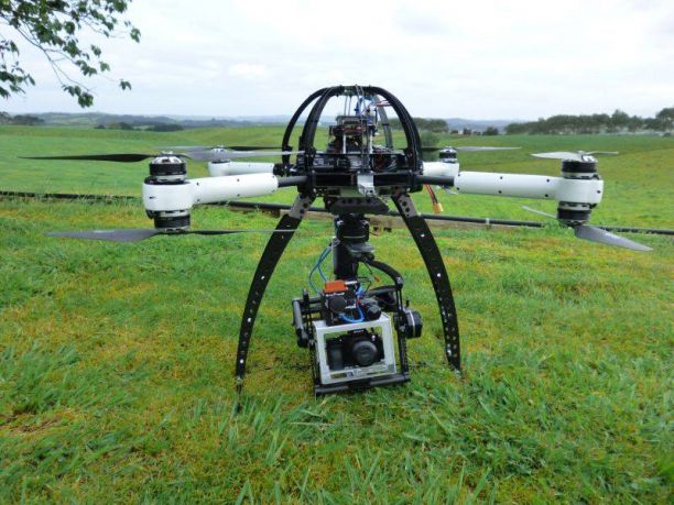
As technology becomes smaller and more affordable, unmanned airborne systems (UAS), commonly called drones, are becoming more accessible for data gathering and research.
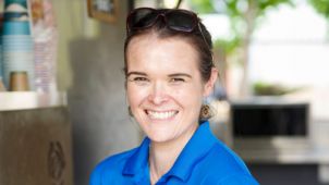
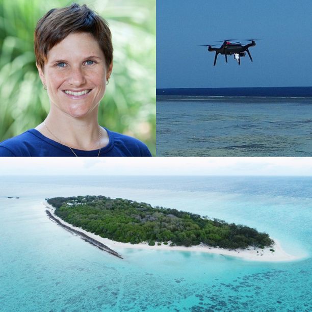
Associate Professor Karen Joyce from James Cook University’s College of Science and Engineering is excited about the opportunities, and efficiency, that drones, or UAS, bring to her field.
“My main interest is using it as a way we can capture image data for environmental monitoring,” she says. “They give us that ability to look at the environment from above but with the same sort of detail that we’d see when we’re actually on the ground.”
The machines can be used in a variety of areas including national parks, agricultural land or, in Karen’s case, marine areas.
“One of my main areas involves coral reefs – looking at habitats, how healthy the coral is, sea grasses, that sort of thing,” she says. “We also do work in tropical savannahs looking at fire ecology as well. There’s a really broad range of application that we can get into just by having the technology available to us.”
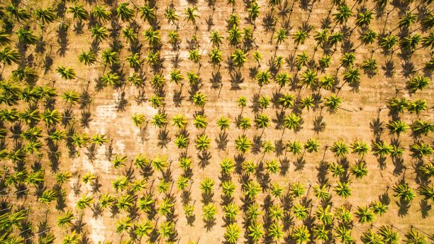
Another application for UAS is in agriculture where it could be used to make assessments faster and more accurately than humans could.
“If you capture lots of photos over an area, bring it back and put it into a computer system, you can train the computer to look at different things,” Karen says. “That could be something as simple as automatically counting mangoes on a tree, through to assessing the health of different crops and the amount of nitrogen or fertiliser they need or the amount of water that’s required.”
The way of the future
Although some people may disregard UAS as the latest equipment fad, Karen believes they are here to stay.
“Technology is going to lead us to places we just haven’t imagined yet,” she says. “If you think back to the Jetsons cartoon it forecast a bunch of things we laughed at at the time – like there’s no way we’d be able to talk to someone on a television screen but here we are with Skype being a normal thing.
“I think there are things around today which may become obsolete because there are just bigger and better things out there - but I think we’re only seeing the start of UAS at the moment.”
Karen predicts that the next step for UAS will be to become more amphibious so they can go under water as well as fly, but the biggest change will be affordability.
“It’s happening rapidly already,” she says. “Something that’s available now wasn’t close to being available six months ago. The prices are coming down and these things are becoming so much more accessible.”
Featured researcher
Karen Joyce
Associate Professor
Associate Professor Karen Joyce graduated from the University of Queensland in 2005 with a PhD in Geographical Sciences. Her focus was on mapping live coral cover using remote sensing. Using her remote sensing expertise for a variety of applications, she has since worked as a Geomatic Engineering Officer in the Australian Army, developed models for spatially explicit mapping across New Zealand’s conservation estate, and developed techniques for integrating remote sensing into all phases of the disaster management cycle.
Karen’s primary area of interest is in creating, applying, and automating remote sensing tools for environmental monitoring and management problems, especially on the Great Barrier Reef. She loves helping people incorporate drones and satellite imaging into their workflows, and is particularly active in encouraging women and young people to consider careers in STEM using drone and geospatial technology.