Drone research takes flight
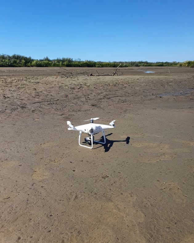
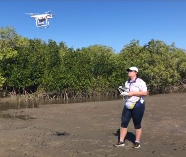
PhD Candidate Sophie Walker says that drones are fast becoming a device to support environmental management practices. Able to take photos and videos from above, and armed with a range of specialised sensors, drones can provide a broad perspective on habitat restoration, land surveying, and environmental changes. Sophie’s investigation of drones’ potential for research and environmental management gives keen insight into how Australians can take environmental action.
With a background in Environmental Management, Sophie says that she is passionate about bridging research with on-the-ground environmental work. “Before I started my PhD at JCU, I was employed by the government and the Queensland Department of Environment and Science to work on licensing and patent applications for coal seam gas,” she says.
“I really liked working for the regulator and seeing how policy and legislation affect what companies can and can’t do within the scope of environmental management,” Sophie says. “After working in consulting, including advising members of the public on legislative changes, I gained a lot of experience speaking with diverse stakeholders. I liked being able to see how I could translate government jargon into language that everyday people use.”
With her background in translating government policy, and a keen interest in furthering her research skills, Sophie decided to take on a new and exciting challenge by completing a Master of Science (Professional) at JCU.
After spending time using drone imagery to monitor wetland restoration projects during her Master’s, Sophie says she decided to pursue a PhD at JCU. In particular, her research project considers the opportunities and barriers to the uptake of drone technology. “I found that we don’t have a lot of knowledge about drone use, particularly in environmental contexts in Australia,” she says.

More than just a pretty picture
Keen to hear from Natural Resource Management groups (NRMs) and government departments about how they utilise drones, Sophie sent out a large survey to people who undertake environmental management work throughout Australia.
“I surveyed hundreds of environmental organisations around Australia. I wanted to hear from people who do on-the-ground environmental work, whether they’re in state or local government departments, or community groups,” Sophie says.
The results of the survey were surprising, with Sophie’s research showing an overwhelmingly positive attitude towards using drones for environmental management, including science communication and research. “Over 70 per cent of the people who took the survey said they were already using drones. It was a really nice surprise!” she says.
“Out of the people I surveyed, a majority of them strongly agreed that drones were beneficial to their work and resulted in good environmental outcomes,” Sophie says. “People were very much in favour of this technology as an important tool within environmental contexts.”
In her research, Sophie says she gained a deeper understanding of the barriers to drone uptake. “The main barriers that people faced were navigating regulations and the cost involved with drones. To me, this was not so surprising.
“What was more surprising, however, were people’s thoughts on these barriers,” she says. “For example, the regulations were considered a barrier because people found them too confusing and were uncertain about what applied to their specific drone use,” she says. “The Civil Aviation Safety Authority (CASA) regulates drone use in Australia, which is the same body that also regulates planes and helicopters. Their regulations are very detailed and precise.”
“In terms of cost, people also expressed that it wasn’t actually the drones themselves that are too expensive. People considered it more costly to purchase specialised drone sensors and, if it was needed, pay someone else to operate the drone,” Sophie says. “An NRM that wants to investigate soil erosion and vegetation needs a very specific type of sensor. These additions to the drone can cost tens of thousands of dollars.”
“Drones are such a versatile piece of equipment that have so many capabilities. You can take images and video for communications and advertising material, but you can also monitor vegetation. There are so many possibilities!”
JCU PhD Candidate Sophie Walker
The sky is the limit
Hearing from these diverse environmental groups, Sophie found that there were almost endless applications for drones. “Drones fill this really important space between on-the-ground surveys and satellite imagery when it comes to monitoring vegetation. Satellite imagery is really excellent and is often available freely online, but it has limitations. For example, cloud cover on a particular day can create poor-quality images.”
“One of the big benefits of drones, however, is that they are really flexible and allow the operator to direct and decide on the type of data to collect,” Sophie says. “If you have a landholder who wants to know what sections of their property look like, for example, they can get a drone to fly over and capture imagery exactly where and when they want.”
“Some groups were also able to create habitat maps and monitor vegetation with drones,” she says.
Other environmental groups said they used drones a little differently. “A lot of other people said they use these drones for communications and creating advertising material related to their environmental work,” she says. “Many NRMs said that drones are really useful for developing videos and images that can help visually communicate with politicians and policymakers.”
“With a drone, you can create a beautiful before and after image of a wetland, or create a video of land restoration. Drones make it really straightforward to communicate research impact.”
Looking to the future of drones and their place within environmental management, Sophie says they are becoming increasingly accessible and their uses are rapidly expanding.
“There are many avenues for encouraging drones within environmental management,” she says. “I think it will be important in the future for people to share their knowledge about drones. At the moment, it seems that many people are in their own silos and each group has to start from scratch when they begin using drones. Knowledge sharing is really important for us to develop in this field.”
“My passion is for marrying research with government and environmental management. Research makes a lot of interesting findings, but it’s really important to connect this work with environmental management groups on the ground.”
JCU PhD Candidate Sophie Walker