Agriculture Technology and Adoption Centre (AgTAC) Research Impact Drones & AI team up for healthy land management practices
Drones & AI team up for healthy land management practices
- MRCMHR
- Future Students
- JCU Global Experience
- International Students
- Student experience
- Open Day
- How to apply
- Pathways to university
- Living on Campus
- Courses
- Publications
- Mature students
- Scholarships
- Entry options
- JCU Families
- JCU Heroes Programs
- Aboriginal and Torres Strait Islander in Marine Science
- Elite Athletes
- Defence
- Capability.Co
- AI@JCU
- AALL
- Current Students
- Student Ambassador Program
- New students
- JCU Orientation
- LearnJCU
- Placements
- EDQS
- Unicare Centre and Unicampus Kids
- Graduation
- Off-Campus Students
- JCU Job Ready
- Safety and Wellbeing
- JCU Prizes
- Professional Experience Placement
- Employability Edge
- Art of Academic Writing
- Art of Academic Editing
- Careers and Employability
- Health, Wellbeing and Belonging
- Career Ready Plan
- Careers at JCU
- Partners and Community
- School Outreach and Widening Participation
- Alumni
- International partnerships
- About JCU
- Reputation and Experience
- Chancellery
- Governance
- Celebrating 50 Years
- Academy
- Indigenous Engagement
- Education Division
- Research Festival
- Graduate Research School
- Research Division
- Research and Innovation Services
- CASE
- College of Business, Law and Governance
- College of Healthcare Sciences
- College of Medicine and Dentistry
- College of Science and Engineering
- MPE
- Anthropological Laboratory for Tropical Audiovisual Research (ALTAR)
- Rural Remote and Tropical Health Systems
- Agriculture Technology and Adoption Centre (AgTAC)
- Advanced Analytical Centre
- AMHHEC
- Aquaculture Solutions
- AMHRA
- JCU Digital Wellbeing Group
- ARCSTA
- Lions Marine Research Trust
- Australian Tropical Herbarium
- Australian Quantum & Classical Transport Physics Group
- Boating and Diving
- Clinical Psychedelic Research Lab
- Centre for Tropical Biosecurity
- Centre for Tropical Bioinformatics and Molecular Biology
- CITBA
- CMT
- Centre for Disaster Solutions
- CSTFA
- Cyclone Testing Station
- The Centre for Disaster Studies
- Daintree Rainforest Observatory
- Fletcherview
- JCU Eduquarium
- JCU Turtle Health Research
- MARFU
- Orpheus
- TESS
- JCU Ideas Lab
- CADSI
- CNL
- TARL
- eResearch
- Indigenous Education and Research Centre
- Past Course and Subject Handbooks
- Estate
- Work Health and Safety
- Staff
- Discover Nature at JCU
- Cyber Security Hub
- Association of Australian University Secretaries
- Services Division
- Environmental Research Complex [ERC]
- Foundation for Australian Literary Studies
- Gender Equity at JCU
- Give to JCU
- Indigenous Legal Needs Project
- Inherent Requirements
- IsoTropics Lab
- IT Services
- JCU Webinars
- JCU Events
- JCU Motorsports
- JCU Sport
- Library
- Mabo Decision: 30 years on
- Marine Geophysics Laboratory
- Office of the Vice Chancellor and President
- Outstanding Alumni
- Policy
- PAHL
- Queensland Research Centre for Peripheral Vascular Disease
- Rapid Assessment Unit
- RDIM
- Researcher Development Portal
- Roderick Centre for Australian Literature and Creative Writing
- Contextual Science for Tropical Coastal Ecosystems
- State of the Tropics
- Strategic Procurement
- Student profiles
- SWIRLnet
- TREAD
- TropEco for Staff and Students
- TUDLab
- VAVS Home
- WHOCC for Vector-borne & NTDs
- Media
- Copyright and Terms of Use
- Australian Institute of Tropical Health & Medicine
- JCU Respect
- Pay review
- Research
Researchers are using high resolution drone imagery and AI technology to develop new tools for land condition assessment in the rangelands of north-west Queensland.
Drones allow people to capture high resolution images that can be highly useful for agricultural and rangeland management. For example, drone imagery can provide information about the health and condition of pasture in paddocks, the amount and distribution of weeds, as well as the locations of roads, fences and water sources.
To harness the full potential of such imagery, we need to be able to easily detect and classify key features present in each photograph.
Recent developments in artificial intelligence (AI) are opening the door to the more accurate and efficient classification of these features, helping to improve planning and management processes.
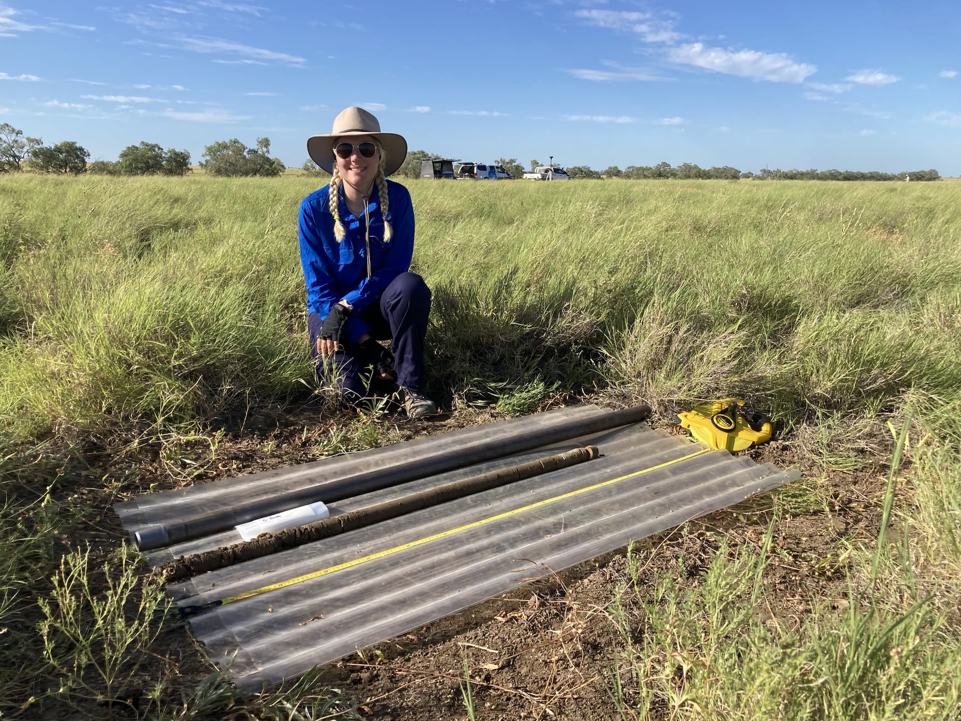 Lucy Gardner with a soil core in a paddock in north-west Queensland.
We hope this approach will enable rapid and accurate assessment of Mitchell grass tussock density within a paddock. If new images are collected, these can also be input into the model, allowing one to track changes in tussock density through time. This approach could be utilised by graziers, natural resource management groups and other stakeholders to aid in land management decisions. - Dr Jack Koci
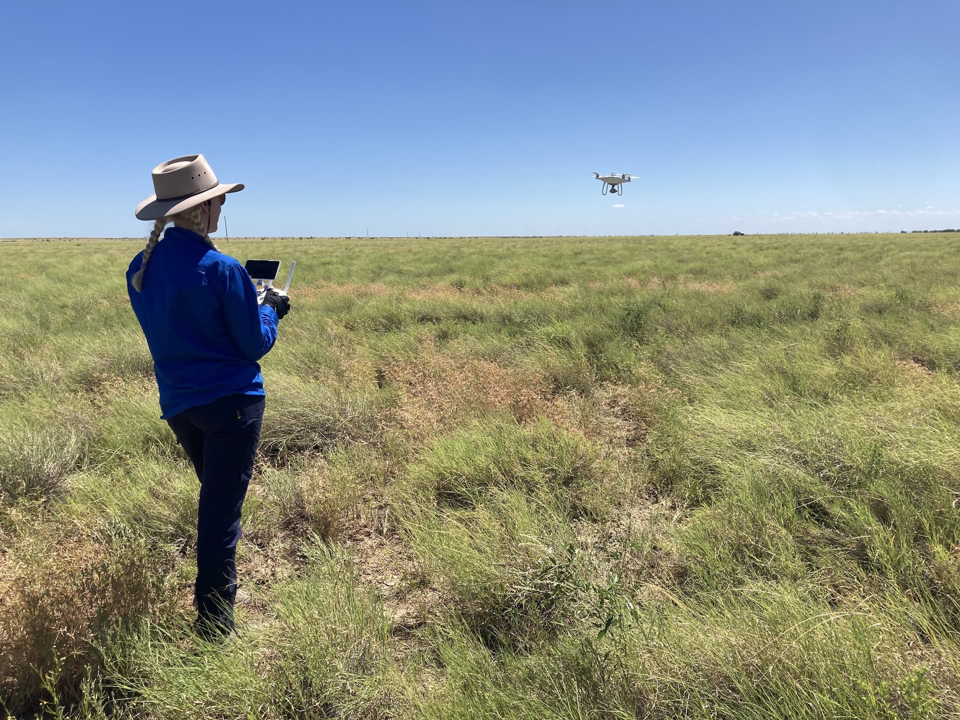
JCU Honours Student and AgTAC member, Lucy Gardner, supervised by Dr Jack Koci, is part of the team including Southern Gulf NRM, Maxus AI and the Tropical North Queensland Drought Hub, trialling the potential of integrating drones and AI technology.
![]()
![]()
The trial is being undertaken across the Southern Gulf of Queensland and is focussing initially on the identification and classification of Mitchell grass tussocks (Astrebla spp.).
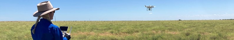
At each site, Lucy flies a drone collecting images of the paddock. The images are the fed into an AI platform. Individual tussocks of Mitchell grass appearing in a small subset of the images are then identified and manually labelled by Lucy. The labelled images are then used to train the AI model to automatically identify Mitchell grass tussocks in all other collected images.
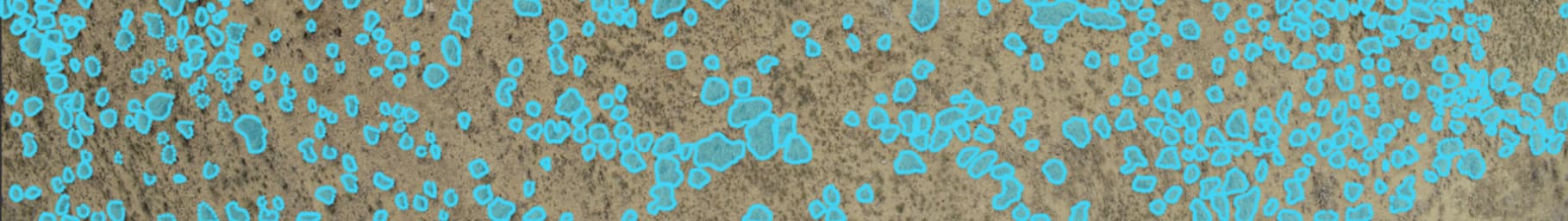
Example of Mitchell Grass tussocks identified by the AI Platform.
The project is supported by the Tropical North Queensland Drought Hub with funding provided by the Australian Government’s Future Drought Fund and is operating from 2022 to 2023.
![]()
![]()
Contact details